


Saturday 7 April 2007
Devin has unwittingly reminded me that I have been wanting to put up some maps of Lothere.
First of all, where is Lothere? We know it’s in Britain, and I hope it’s clear that it’s in the border country between England and Scotland – which border was frequently changing at this time period. I have also hinted that it’s west of Northumbria. And, for the serious detectives, I have placed it south of Carlisle, since Carlisle was called Leol at that time, and I have mentioned Leol once or twice as being on the way to Scotland.
That’s enough information to put it in the Lake District of northwest England. However, I have been deliberately vague about its exact location, because it is impossible to fit it anywhere in the real world. I’ll tell you the story of how it evolved so you can how I painted myself into this corner.
When I started the story as a Royal Kingdom Challenge I didn’t have a region of England picked out, except that it was far from London. I simply chose a nice neighborhood terrain and started building.
Here is a picture of the core of my neighborhood as of 1085, with south at the top:
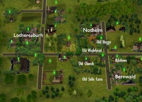
All of the original houses are labeled. (The Selle farm is gone since it was destroyed in 1077 by a fire.) You can see the road running between Nothelm and Bernwald, which was an element of the story as early as 107000, since the Selle farm was on the way and Alred was stopping in to see Githa.
There is also the crossroads at which so many bad things happened, then the road running towards the King’s castle, along which were Egelric’s first house and the old church.
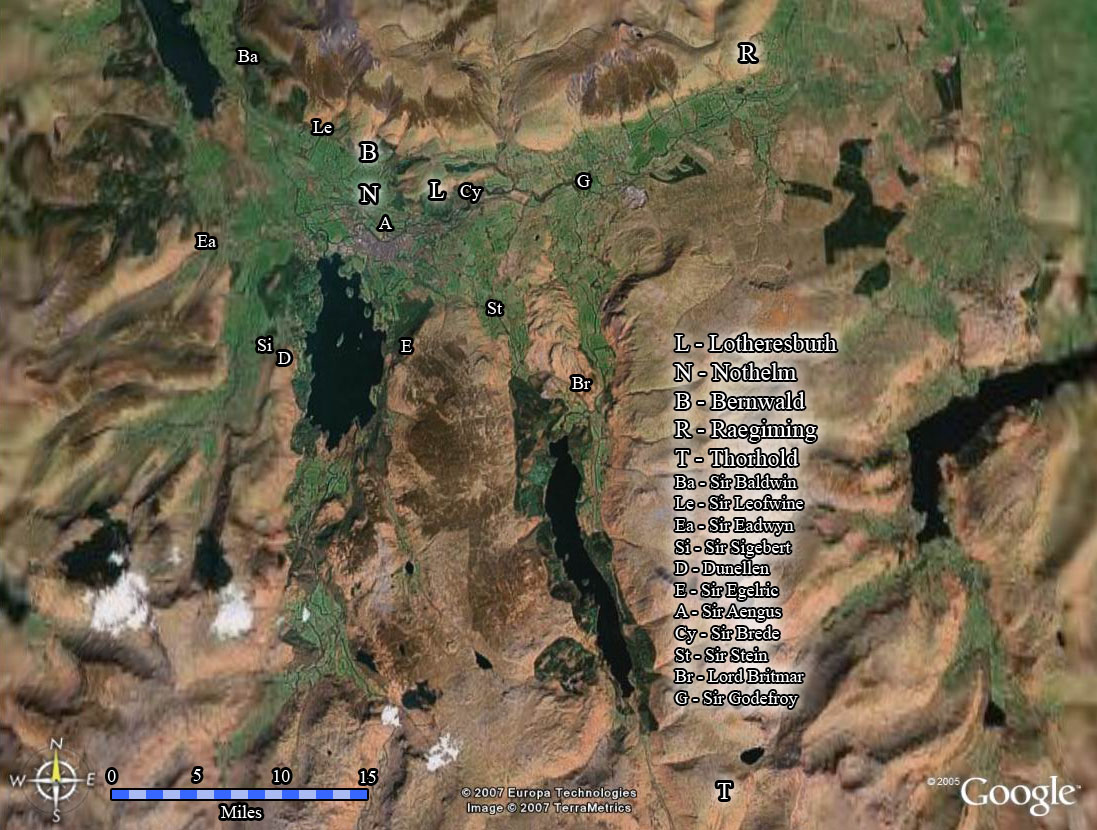
After a while, I was playing around with Google Earth wondering where in England my story might be located. When I zoomed in on Cumbria, I even found this great little valley:
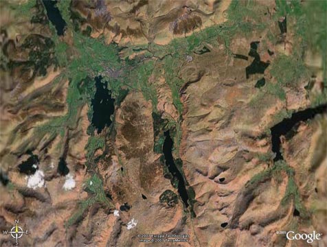
I realized I could adopt the geography of this valley as the geography of Lothere, and I could even use Google Earth’s placemark feature to label all the locations in my story. The truth is, I have been using Google Earth to store my only “map” of Lothere. I can even see 3D terrain – check this out:
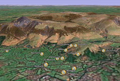
So I arranged the pointers for each of my castles and houses according to the orientation of everything in my neighborhood, and for a while everything was good.
Ignoring the fact that I have disregarded the actual historical people who used to live there, how lucky that the valley I chose actually lies in the location where I wanted to place my story. Right?
But I had paid no attention to scale when setting up my map. Worse, I had already implicitly given the size of my valley, because I had said that it takes six hours or so to ride to Thorhold and three to Raegiming.
I figured out that my valley is approximately four times the size of the real world valley it is based on. Great news for Sigefrith, not such great news for me. It would take up almost all of Cumbria, so here’s where I wave my magic wand and reshape the geography of northwestern England. Either these hills and valleys take up a lot more of Cumbria than you think, or Cumbria has ballooned out into the Irish Sea.
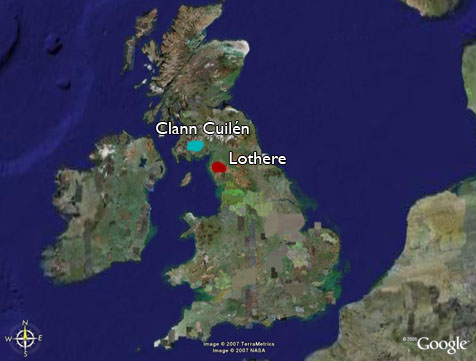
Here is a non-ballooned map of Britain showing the rough location of Lothere (probably not to scale):
I also added the approximate region controlled by Lord Aed: a rather hilly part of Galloway, in short. My apologies to the actual historical Scots in control of the area at the time. The little island between Britain and Ireland is the Isle of Man, currently ruled by Eirik’s lord, the Norseman Godred Whitehand.
While we’re on the big maps, here’s a map of Europe in 1100 (click for a closeup):
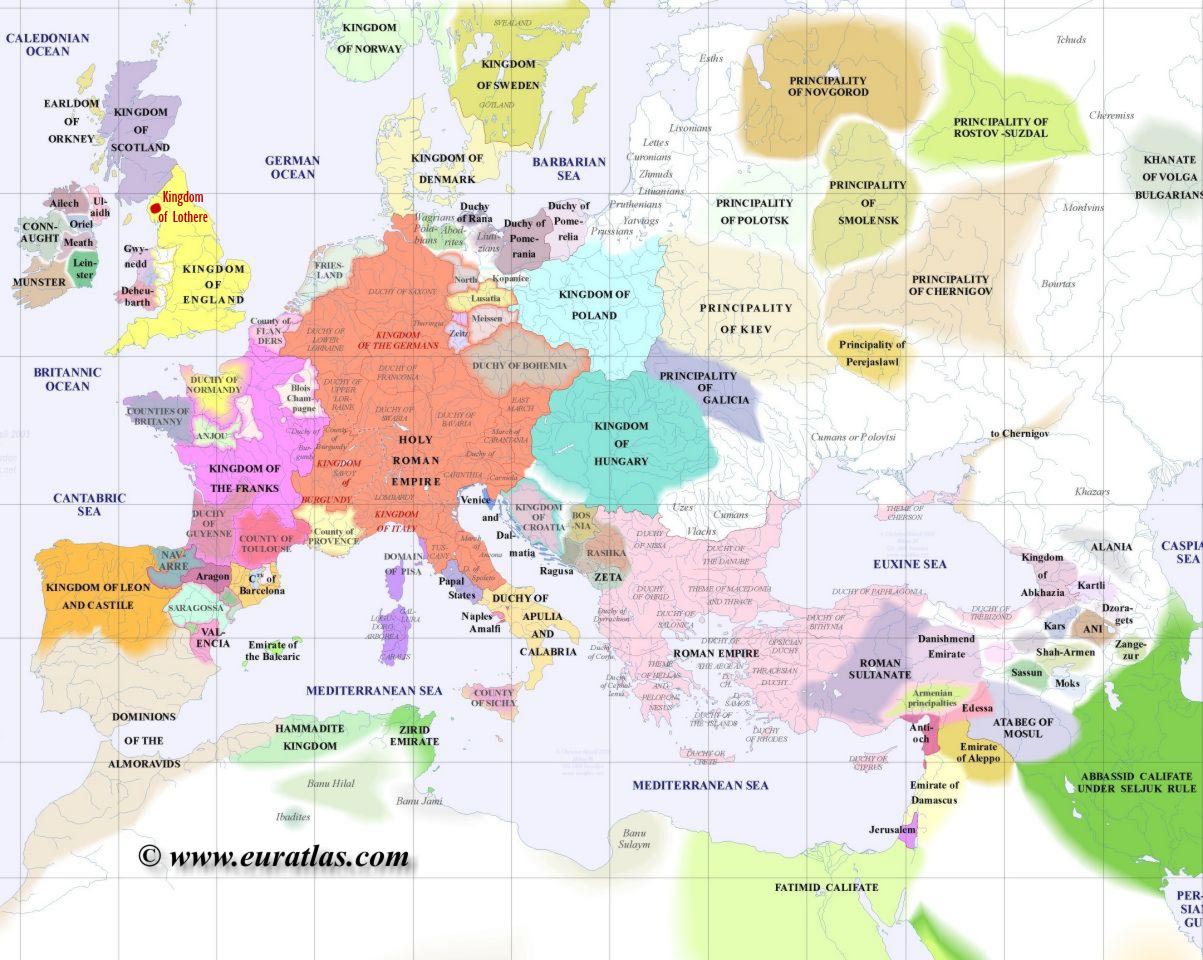
Some noteworthy places that have come up in the story are the kingdoms of Ailech and Leinster in Ireland (the latter currently being ruled by Murchad’s uncle); Gwynedd in Wales (the birthplace of Matilda’s mother); the County of Flanders on the continent (Hi, Yicke!); Saxony in the northern part of the Holy Roman Empire; and Denmark, which includes part of what is now southern Sweden (Hi, Verity!). In southern Spain and North Africa, there is also the Dominions of the Almoravids, which is where Leila is from. Eirik & Hilda’s home in Norway is too far north to appear on this map.
Back to Lothere, here’s an overview map showing the locations of the castles, manors, and important landmarks as of 1085 (click for a closeup):
Notice how the big B, N, and L in the top there have the same orientation as in my original neighborhood, except that north is now at the top.
Here is a “political map” of Lothere, showing how the land is divided up between Nothelm, Bernwald, Lord Leofric’s Raegiming, Lord Baldwin’s Acanweald, Thorhold, and the King’s own lands (click for a closeup):
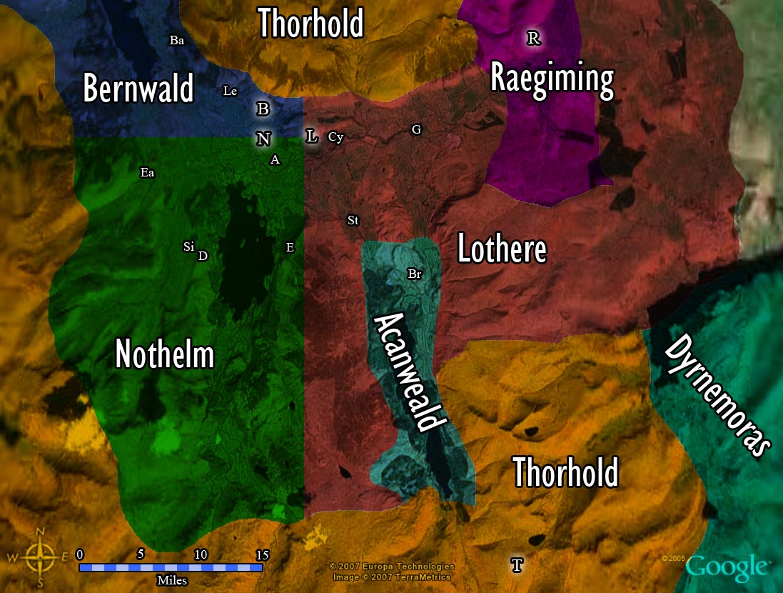
Dyrnemoras is not technically part of the kingdom, but they are allies of Baron Theobald and hence allies of Sigefrith. Its lord is currently Ealdwyn Ealstan, the uncle of Egelric’s steward, Ethelwyn.
Here is a close-up view of the original core of the neighborhood, again with north at the top (click for a closeup):
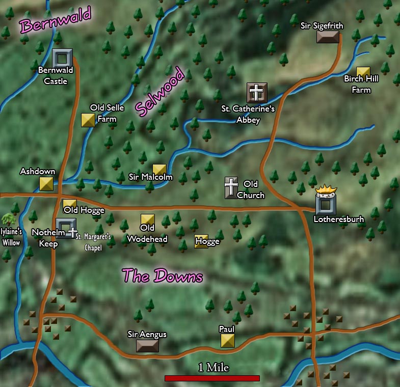
None of the buildings are to scale here, but the distances between them are correct according to the mile scale at the bottom.
There are obviously other farms besides those of the characters we know, but other than indicating the locations of the two important villages near the river, I haven’t thought about where the other farmers live. The two big market squares are in the villages, also.
This map also allows you to see how some of the borders of the political map are determined: the border between Nothelm and Bernwald lies along the main road running westward from the King’s castle. The border between Nothelm and the King’s lands is determined by the “King’s Road”, which runs south from the castle. If that line were continued southward as far as the hills, it would form the border.
So that’s about as much as I myself know about the geography of Lothere. I apologize for any inconsistencies that have crept in over the “years”. I think they are not many, as detail-obsessed as I am. And If I left anything out, leave a comment and I’ll locate it for you.

Wow, that is awesome, Lothere! To think that a challenge could turn into, well, this! Do you think you will ever 'finish' it? Or will Lothere go on until you've grown tired of it?