


Sunday 3 May 2009
Due to recent developments in the story, I thought it might be worth putting up some maps to help everyone understand the geopolitical situation. (Oooh look Ma, I’m writing a story with a geopolitical situation! ") )
)
First, here is a map of the Irish Sea in the area between Man, Cumbria, and Galloway. (Click to see the big version.)
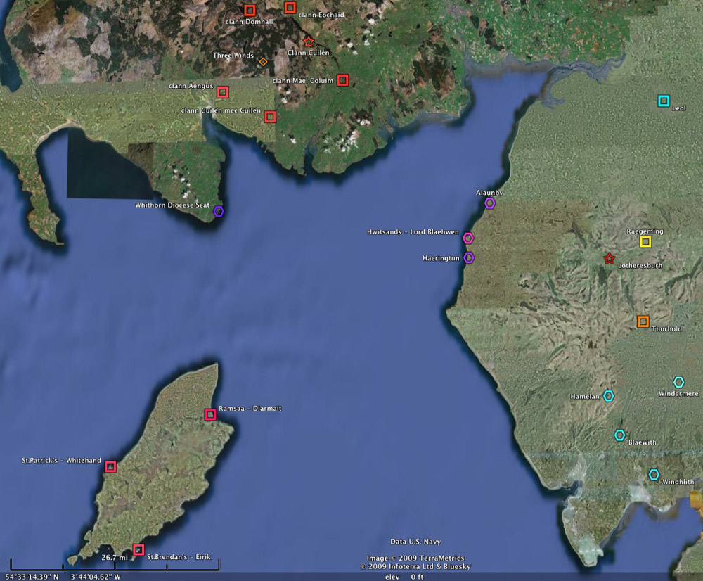
Man is in the lower left.
The cluster of red at the top are the lands of the various sub-clans of Aed’s clan. Aed’s hall is marked with the star. The spot marked “clann Aengus” is Young Aed’s land, and “clann Cuilén mec Cuilén” is Eochaid’s. Aed’s ships are kept along that coast, which is the only part of the sea coast he really controls.
Lothere is off at the right edge of the map… just keep in mind that it’s actually four times larger than it appears on the map, due to my early carelessness to detail. ![]() Sigefrith’s castle is marked with the red star.
Sigefrith’s castle is marked with the red star.
Next is the larger situation of Britain and Ireland:
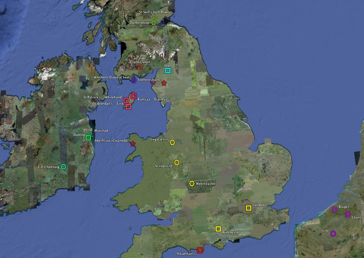
Man is in pink, Ireland is in green, Flanders (homeland of Ogive and many of Leofric’s ancestors) is in purple down at the lower right. Cearball comes from Cill Channaig in Ireland, though he spends most of his time in Dublin.
Hwaelnaess is the red square at the very bottom of the map. Gwynn’s grandmother’s “fairy tale castle” is the purplish star on the coast of Wales (due south of Man).
Dunfermline, where the King of Scotland spends most of his time and where Cian just got back from, is marked with a yellow-green star at the top of the map.
The three yellow towns I marked in the middle of England aren’t of much interest except that they fall on the route Leofric and Theobald are planning to take to Winchester.
Wow. Everything is sooo close together in the UK.