


Saturday 15 May 2010
After the latest chapter, “Gunnora comes to the crossing of seven roads,” I thought we needed a good map of the area, so I threw one together this morning. (Click for a big version.)
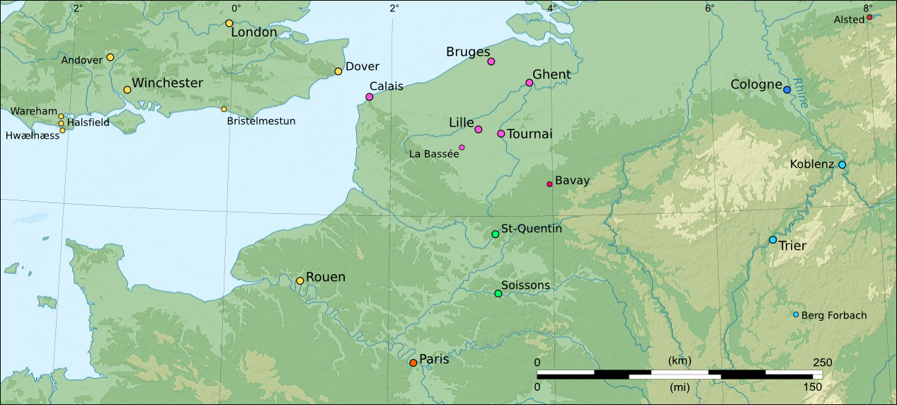
Finding exact borders between all these duchies, counties, kingdoms, and ecclesiastical city-states at a given moment in time over nine hundred years ago is practically impossible, so I didn’t bother trying. I did color-code the city labels to show what territory they belonged to in 1086, as near as I can tell.
- Yellow
- Kingdom of England and Duchy of Normandy
- Magenta
- County of Flanders
- Fuchsia (is there a difference?)
- County of Hainaut – at times during our story this was part of Flanders, but not in 1086
- Green
- County of Vermandois
- Orange
- Kingdom of France
- Dark Blue
- Duchy of Lower Lotharingia
- Light Blue
- Duchy of Upper Lotharingia
- Brick Red
- Saxony
I think I covered all the places mentioned in the story so far.
As long as I am at it, here’s a map of the Isle of Man. I plan on putting up a Maps section of the site one of these days, but this map is already done.
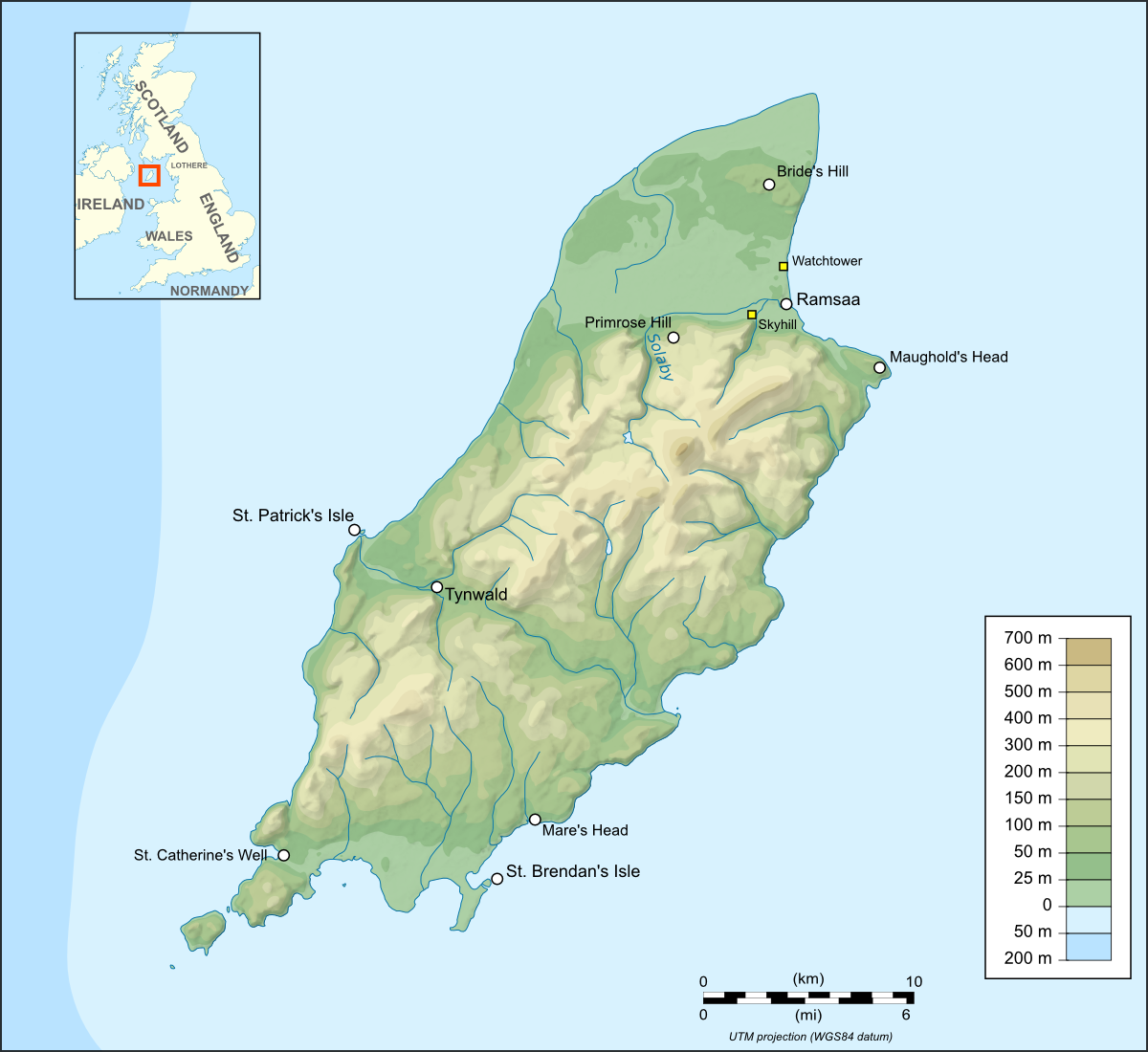
These maps are licensed under Creative Commons Attribution-Share Alike 3.0. Credit for the original images goes to Eric Gaba for both France (on which the map centered on Flanders is based) and the Isle of Man.

Hi Lothere
If it could help, I have a historical atlas that has pretty detailed maps of france and germany, but especially Belgium and the Netherlands in the 10th to 14th century. If you would like, I will try to scan it and send them to you?